Press Releases
12-08-2022 15:13
Unexpected developments during the 2022 excavation season at the Palaepaphos-Laona tumulus
The Department of Antiquities of the Ministry of Transport, Communications and Works, announces the completion of the University of Cyprus (UC) annual excavations (first phase) on the tumulus of Laona (FIG.1). Field work is carried out in the context of the “Palaepaphos Urban Landscape Project” (PULP), directed since 2006 by Prof. Maria Iacovou of the Archaeological Research Unit (FIG.2). This year, the project began in May with a geophysical survey of the mound (FIG.3) by Prof. A. Sarris (Digital Humanities GeoInformatics Laboratory, UC) in collaboration with the Geophysical-Remote Sensing & Archaeoenvironment Lab (Institute for Mediterranean Studies, Foundation for Research & Technology Hellas). It continued with targeted excavations on the north side of the mound directed by Prof. Jacopo Tabolli (University of Siena - UNISTRASI) (FIG.4), and it was completed with a new UAV survey of the excavated monuments by Dr Kyriakos Themistokleous and Dr Athos Agapiou (Remote Sensing & Geo-Environment Lab, Cyprus University of Technology).
Tumuli of monumental dimensions, like for example the grand Macedonian tumuli, were until recently almost unknown in Cyprus. In 2011, the hillock of Laona, one km to the NE of the sanctuary of Aphrodite in Palaepaphos-Kouklia, was identified as an artificial mound. Its dimensions are considerably greater than those of the Salamis tumulus raised over the so-called “cenotaph of Nikokreon”. Over the last decade, the mound became the subject of specialised studies by PULP; it is gradually being excavated and documented digitally. The first unexpected discovery that surprised the archaeological team was the revelation of an earlier monument, a Cypro-Classical rampart, on top of which the mound was erected, most probably at the end of the 4th c. or early in the 3rd c. BC.
Besides exposing the east side of the rampart and its two facing staircases (FIG.5-6), the field team proceeded to dig vertical cuts into the mound that were essential for the geoarchaeological study of the earth materials employed in the construction of the tumulus (FIG.7). The microstratigraphic analysis revealed the method and the different stages of its construction and was published last year in Geoarchaeology (Μ. Gkouma, P. Karkanas and M. Iacovou (2021), A geoarchaeological study of the construction of the Laona tumulus at Palaepaphos, Cyprus. DOI: 10.1002/gea.21850). The study confirms that the tumulus of Laona is an accomplished architectural structure that was built by experienced engineers to become a lasting mega-monument in the landscape.
The 2022 field team was met with another surprise when the rampart, instead of turning to the west under the mound’s summit (at 114m asl), was found crossing over to the north side. Its wall follows a descending NW course, and it is in an excellent state of preservation (FIG.8). Together with the east section, the total length of this rare defensive monument is currently 160m.; its internal area is at least 1,740 sq.m. (FIG.9). The width of the rampart is 5m. and it is built with stacks of mould-made mudbricks placed between parallel walls of unworked stones (FIG.10); worked stones are employed in the construction of the corners (FIG.11).
Sections of the use layer (floor) of the rampart, that were exposed near the foundations of the wall, show that the bedrock had been levelled; a thick layer of river pebbles was placed on top of it and on top of that a layer of red soil, which is full of sherds (FIG.12). The red soil is currently being analysed to determine whether it has the same consistency as the mudbricks.
A third staircase, less well-preserved than the two staircases on the east wall, was discovered on the highest surviving sector of the rampart. The steps are made of mudbricks, but for reasons of security, their excavation was discontinued after the first five steps were exposed (FIG.13-14). Granted that the foundation trench of the wall in the NW corner is 104,75m. asl., the surviving height of the rampart by the northern staircase (112, 95m.asl.) is 8m. It is, therefore, extremely dangerous to try to expose it. The security of the team members and the preservation of the wall and the staircase are a priority. The strata of the tumulus that continue to encapsulate the staircase cannot be removed unless a consolidation and preservation project has been approved in advance.
Laona combines two monuments that are so far unique in the archaeology of Cyprus. The royal dynasty that ruled Paphos to the end of the 4th c. BC is credited for the construction of the rampart, which is chronologically and functionally related to the palatial and the workshop complexes on the citadel of Hadjiabdoulla, only 70m. to the south of Laona. The rare and mysterious tumulus, which until recently concealed the existence of the rampart, is a mega-monument whose construction would have required the mobilization of a huge and experienced work force under the guidance of expert engineers. From now on, a main goal of the Laona project is to show that Laona is a burial tumulus; also, to identify the political agent behind its construction.
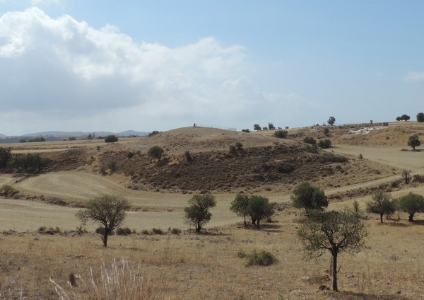
FIG 1. The mound of Laona. North side before the 2022 excavation.
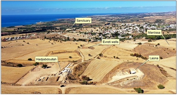
FIG.2. ‘Palaepaphos Urban Landscape Project’ (PULP). Main sites within the urban nucleus of the ancient polity (Remote Sensing & Geo-Environment Lab, Cyprus University of Technology).
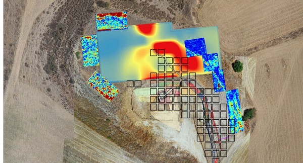
Fig.3. Laona ground plan with 2022 geophysical survey.
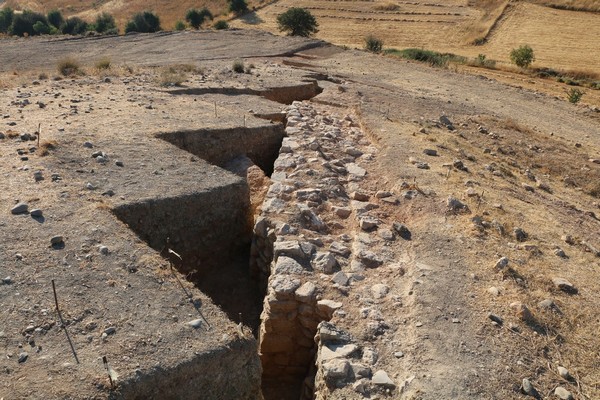
FIG.4. Laona 2022. The wall of the rampart exposed on the north slope of the mound.
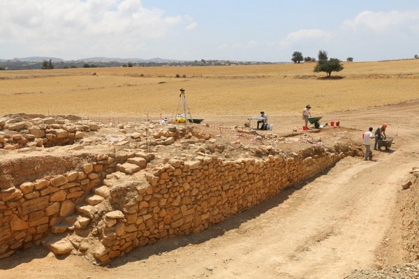
FIG.5. East side of the rampart with the southern staircase.
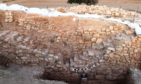
FIG.6. The facing staircases on the east side of rampart
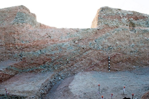
FIG.7. Main north to south cut for the geoarchaeological study of the mound’s construction.
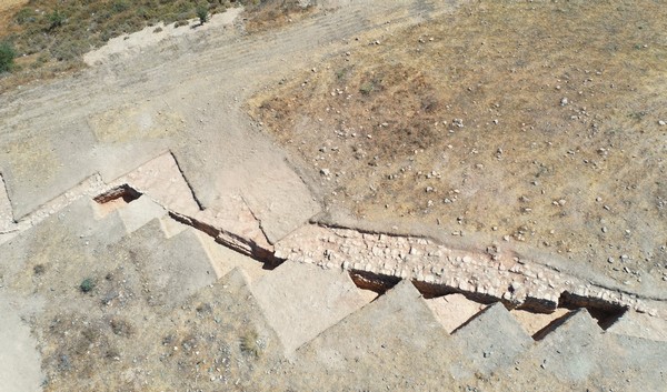
FIG.8. Laona 2022. NW course of the rampart on north slope.

FIG.9. Laona 2022. UAV photo showing 160m of the east and NW course of the rampart (Remote Sensing & Geo-Environment Lab, Cyprus University of Technology).
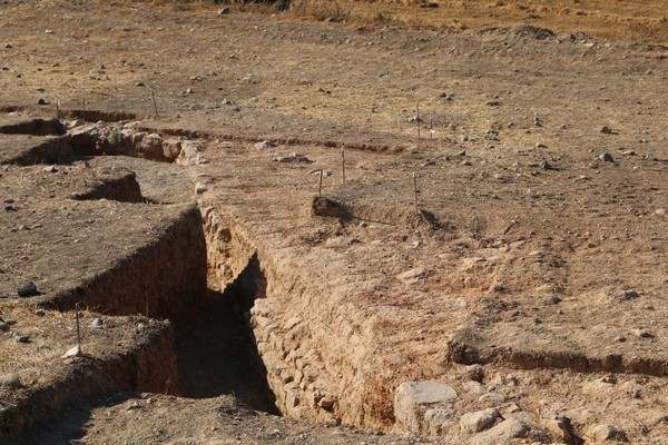
FIG.10. Mould-made mudbricks in between walls of unworked stones on N. side of mound.
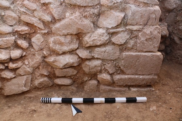
FIG.11. Corner of rampart with worked blocks.
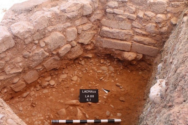
FIG.12. Use layer of rampart with red soil on top of layer of river pebbles.
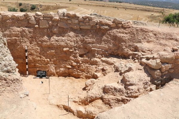
FIG.13. The north (third) staircase.
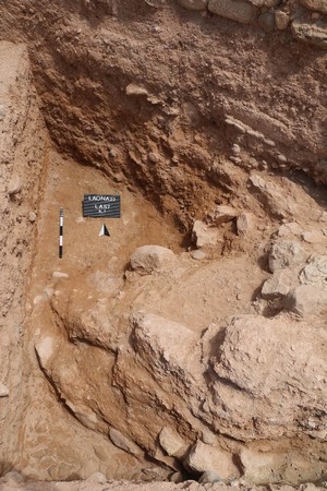
FIG.14. The first (from the top) steps of the north starircase.
(TG/NG/SCH)
Relevant Press Releases


